Dec 26 we left for 3 nights in Kanab. We hiked 4 times. The day we arrived and the 3 days after. Hikes included The Toadstools, Wire Pass, Upper Buckskin Gulch, and Yellow Rock.
The Toadstools trailhead is 44.5 miles east of Kanab on hwy 89. The hike is about 2 miles roundtrip.
This is the red toadstool you come to first after about .5 miles hike up the wash. There is one pour over on the way that can be bypassed on the right if you back up about 50 feet and take the high trail.
After passing the red toadstool, go past it on the left and see this red plateau at the base of the white cliff. There are more white toadstools around the corner to the left.
Some of them are taller than they look in photos without people.
This one is on top of the white cliff. We did not get to it but suspect there are more up there and the route would be up a wash to the right of the red toadstool past the end of the red plateau into the next wash.
The second day we tried to get a walk in permit for the wave. The odds were about 1/80 and we didn't get it. So we went to the same trailhead as the Wave and hiked Wire pass which has self issue permits at the trailhead for $6.00 per person. The trailhead is 8.5 miles down House rock valley road, which is 38 miles east of Kanab.
Heading down the wash to Wire Pass. Wire Pass is a slot canyon that connects to Buckskin Gulch, the longest slot in the world.
After about .5 mile we reach the entrance to the slot.
The light was pretty good.
After about 200 feet into the narrow part there is a chock stone causing a 8 foot drop that would be very difficult to navigate if not for some logs you can climb down. The logs are not very stable and we decided not to risk it. There is a climb around on the right just before you enter the narrow part, but we didn't know it at the time.
John in the narrows.
Instead we went left trying to bypass the slot an had an interesting cross country hike.
View of a mesa that looks like is has interesting sandstone formations.
Pretty, smooth rocks
With stripes even.
Convoluted sandstone.
On our last day we started at a different trailhead and connected the upper buckskin wash to the chock stone in wire pass that stopped us earlier. These are photos from upper Buckskin and into Wire Pass up to the bottom of the chock stone. The hike that day ended up being a full 9 miles.
When walking in the wash there were many chances to follow cow trails to shorten the curves.
Buckskin gulch
Buck skin gulch
This is where wire pass meets buckskin gulch in the sunlight ahead. On the smooth rock on the right are several petroglyphs, but not good enough for a picture.
Ice in wire pass. Water from seeps above fall into the canyon and stay frozen because there is no sunlight in the canyon.
Wire Pass is narrower than Buckskin, but not nearly as long.
This is the chock stone. It looks easy but the logs are unstable and it is higher than it looks.
Sandstone along upper buckskin gulch is similar to the Wave.
Odd sandstone
On the final trek to the cars.
The next day we did Yellow Rock. It is 42.6 miles east of the traffic light in Kanab and 14.2 miles north on Cottonwood canyon road. A good dirt road if it hasn't rained. Park just short of the Hackberry canyon trailhead at the intersection of a dirt road to the right. This would be 1000 feet before the Hackberry canyon parking lot.
Head straight west crossing cottonwood creek on the way to a steep canyon leading to yellow rock. the trail up the steep canyon follows the right side of the canyon. If the creek is not frozen there may be mud to contend with.
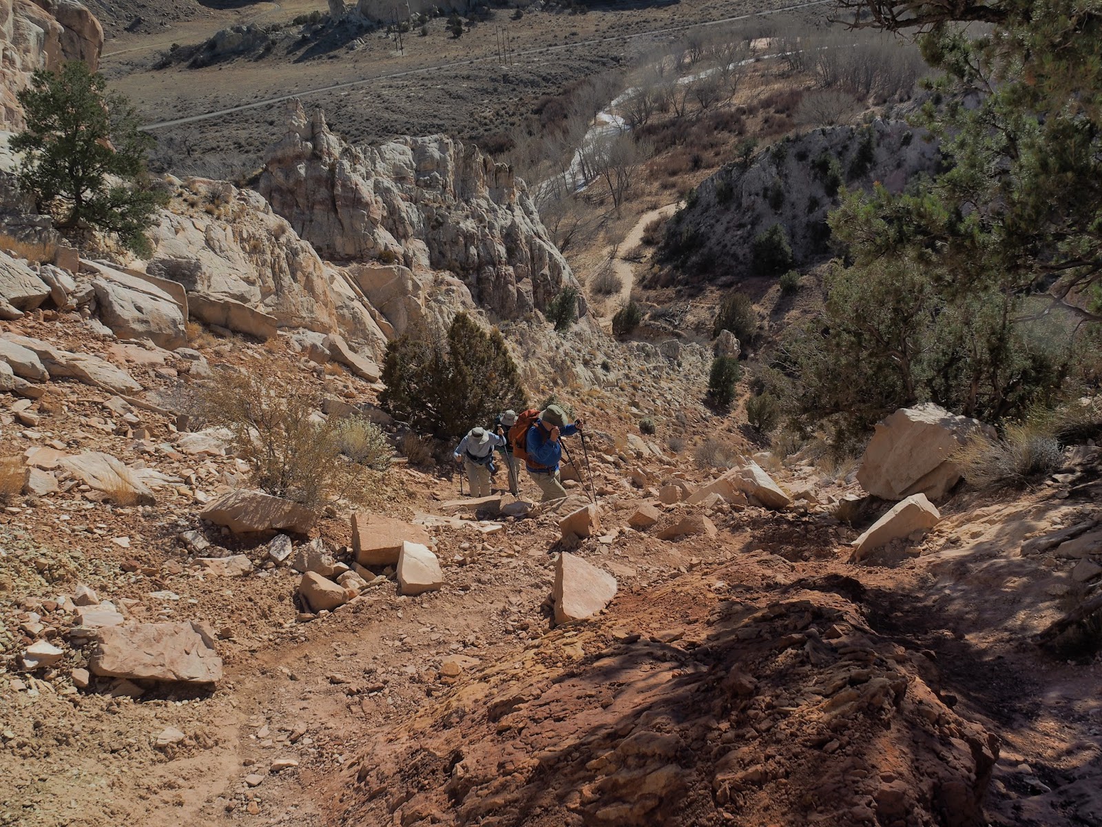
A steep climb up to a ridge where you can't see yellow rock yet.
Looking back down the steep trail to the creek crossing. We were lucky that the creek was mostly frozen. Temps that day ranged from 18 degrees to 66 degrees.
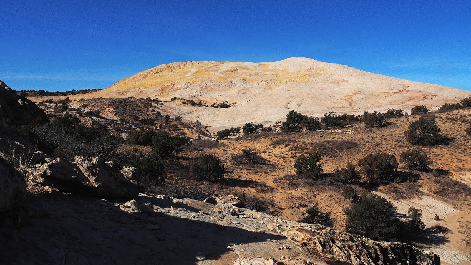
First view of Yellow Rock and two hikers we saw in the parking lot. They were the only people we saw there.
View from the top of the steep slope. Yellow rock is about a half mile away. The walking from here is easy, including walking up to the top.
Group on the slopes of Yellow Rock
Pushing on toward the top
From the top going down
From the top of yellow rock you can see a saw tooth ridge that follows the road north.
Leaving Yellow rock
The steep part. Coming down. About 300 feet vertical in 700 ft distance.
Route map on top. The dimensions of the bare rock is about 3000 ft X 2000 ft. with 1000 feet of gain from the road.
Route map from the cars. We first tried Hackberry canyon but were turned back by mud and thin ice.