Antelope canyon is east of page Arizona. There are 4 outfitters along the side of the road to take you there. Upper and lower antelope are very crowded and reservations are recommended. Canyon-X is about 5 miles east of the main antelope canyon parking lot. It is relatively small. When we were there there(8:30 am) there were only 3 cars in the lot waiting. Antelope had cars lined up outside the gate.
It ended up that we were a party of two and only met two small parties on our excursion lasting about two hours. The guide took this photo with my cell phone.
Some notes on canyon photography. I used a 14mm wide angle lens at f2.8 and a tripod. It is very dark in parts of the canyon and a flashlight is needed to see your camera controls. It is also hard to focus in the dark. I also shot everything in RAW so I could adjust the white balance later incase it turned out wacky in the dark/bright conditions.
Search This Blog
Thursday, August 24, 2017
Wednesday, August 23, 2017
Canyon of the Ancients- Mesa Verde-Hovenweep
Toward the end of our road trip we visited some ancient ruins (1100-1200AD)
I forgot the name of this one. Probably is "square tower" This is from the roadside viewpoint with a tele lens
Wider angle of the same ruin. Shows park workers maintaining it. You can see the rope they used to rappel into it.
Minor ruin from the overlook with a tele lens.
Cliff Palace from an over look with a tele lens
Cliff Palace after the group moved on.
Many window house from the opposite rim with a tele lens.
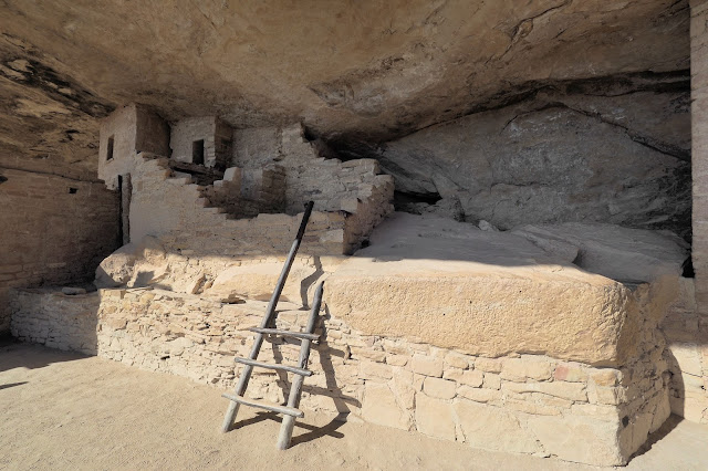
Balcony House is another one where you have to pay a ranger to take you there. It involves climbing a tall ladder and crawling through a rabbit hole.
You get to go right in Balcony House, but no climbing on walls or touching anything.
Detail of stone work
Inside Balcony House.
Climbing the exit ladder.
View of the exit trail.
On to Canyons of the Ancients visitors center in Delores CO where this ruin is.
Statue in front of the visitors center
Sand canyon trail
First ruin we found.
Second ruin we found. We turned around after that because we needed to get down the road and didn't have any trail guide to help us find more ruins. These two were within 1.5 miles of the trailhead.
Now at Hovenweep NM. You have to plan on going there, it is not on the way to anywhere, and is not very big either. It is about 40 miles east- northeast from Bluff UT.
Decomposed Bolder house.
The ruins are scattered around the rim of the canyon. About a 3 mile loop trail will get you there. But from the start of it you can see many ruins across the canyon without having to walk around the end.
The highlight of Hovenweep, a collered lizard posing on a rock.
Driving on toward Monument valley you pass the famous Mexican Hat rock.
Mexican Hat rock
Monument Valley looking south.
Looking north.
Lake Powell near Paige AZ.
Colorado, Telluride and Million dollar highway area
In Telluride they have a free Gondola to take you to the ridge top where you can hike further up.
View from the top of the gondola. You can hike the ridge i'm standing on the left as high as you want. I think it gets to 13,500 (Palmyra Peak) feet after becoming a climb instead of a walk.
View of town from gondola
Town again. Houses are small in town.
Street view.
Red Mountain from Lizard head pass.
Next we went to Ouray and hiked the perimeter trail.
View ahead on the perimeter trail. Fortunately the trail took a turn and avoided this section.
Cascade falls above Ouray.
The trail passes signs of active mining.
More signs of active mining.
Pygmy Nuthatch at the campground
View from our campsite.
Late afternoon view.
First lake on the drive south from Ouray. Reflection of Red Mountain.
Subscribe to:
Comments (Atom)


