Search This Blog

Tuesday, June 22, 2021

Mono pass june 2022


On june 15 we hiked up to mono pass out of mosquito flat trailhead. This was  a very low snow year. Snow conditions were more like the end of summer than the beginning. Flowers were few.


Over looking Little Lakes Valley from a view point of the Mono pass trail.


There were some flowers. This is a Sandwort.


This is the only pink penstemon we saw. They should have been plentiful.


We did see a fair amount of Monkey flowers.


shooting stars.


A series of zoomed in shots of the mountains surrounding Little Lakes Valley.


This is from the mono pass area looking back down the way we came. The trail drops off the lip you can see and turns left to switchback down to the lakes which would be on the other side of the ridge to the left of this snow patch. In a normal June the snow would fill the frame. See the introductory photo at the top of my blog.


The trail went alongside the snow with no reason to step up onto it.

At the top of the pass is a view of a summit lake. Some of the group hiked down to it.


Saw two flowers in the sand. This is a Draba, maybe Lemond's Draba.


This has been identified as a type of Pussypaws. Doesm't look anything like the usual ones you see at lower elevations. This is at 12.000 feet.


Small flat area just before the left turn to switchback down to the lakes again.


Ruby lake view from the switchbacks. June a few years ago when we first scouted this trip, it was frozen over.


A couple of the Little Lakes.


A serviceberry bush.


White mountain road, Mt Barcroft, june 2021

White mountain road is on the ridge east of Bishop CA. It goes north from Westguard pass to the closed gate at the Berkley high altitude reserch facility. the gate is at 11,700 feet. The road is graded but with embedded sharp rocks making slow driving advisable.


A few miles from the gate is the Patriach grove of Great Basin bristlecones. This one is the Patriarch tree. It is said to be the largest one in the world. However there is a larger one in NV that is documented in the national champion tree database at American forests . org.


A small alpine buckwheat just starting to bloom.


The upper parts of the road are well above timberline and offer great views.


At one point, before the gate, you get a view of the  high point on the ridge. White mountain peak, 14,252. From the gate it is a 15 mile RT hike along the jeep to the top. Usually, one day a year the gate is opened for hikers to drive to the research facility and cut off 4 miles of hiking. That would be the day to hike the summit.


A subaru can handle the road just fine. AT tires would be nice however.


The road passed thru areas that are very very barren.


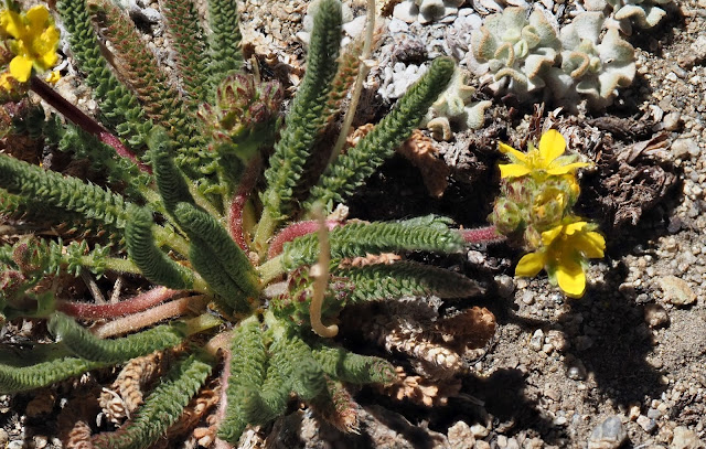
We tried to hike from the gate to the closest peak, Mt Barcroft, at 13,040 but were turned back by very high winds. maybe 50 mph. The only flower we saw there was an unidentified type of Ivesia.


Marmot skull


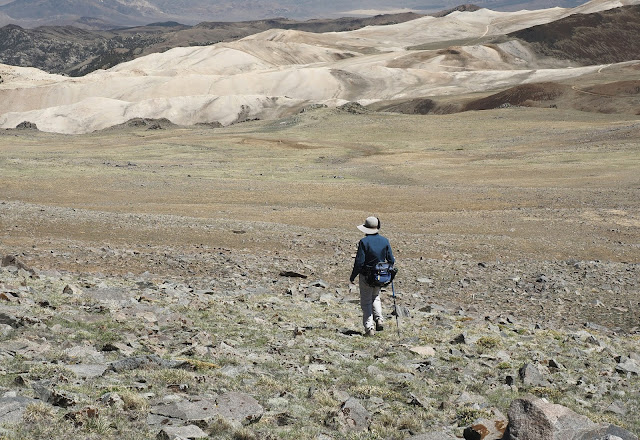
Starting out toward Mt Barcroft. Not far, and not much elevation gain but is is mostly above 12,000 feet and the wind was very strong.


A little knob on the way.


Heading back down to the car.


One other flower we saw on the hike. A buckwheat just starting to bloom.


Mt Barcroft is the hill you see here. We made it to the base of the rocky outcrop just before it. Some in the party made it to the saddle.


The only wildlife we saw.
 

Parowan Gap petroglyphs

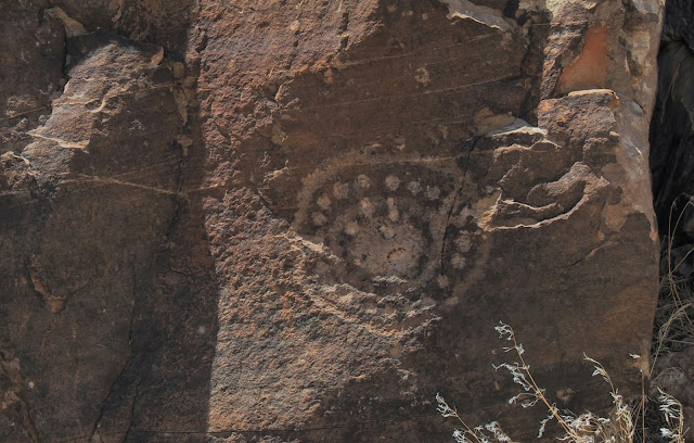
These are a set of petroglyphs I had not visited before. They are off I-15 near the town of Parowan, about 10 miles west in an obvious gap in a ridge and right next to the road. When I photograph petroglyphs there is usually a glare from sunlight on the desert varnish that makes it difficult. The answer to  this problem is a polarizing filter on the camera.