A few from our hiking club planned a trip in May to Kanab to see South Coyote Buttes which we had a permit for. We went for a week and did other hikes on the other days.
The first day we hiked lower Hackberry Narrows
The second day of hiking we went to South Coyote Buttes (SCB). The road there is deep sand and requires high clearance 4 wheel drive. No AWD everyone says. That is why I invited two couples with a Jeep and a truck with plenty of clearance and large off road tires to rescue my Subaru in case my lack of REAL 4 wheel drive and only 9.5 inches of clearance would be a problem. It had not rained in a couple weeks which made the sand somewhat dry but the cool temps at night and moderate temps in the day retained enough moisture that the Subaru was fine. Only scraped the crown of the road a couple times in the deepest spots. All were soft sand so no problem. 99.9 percent of the vehicles that drive here are full sized and create deep ruts that are the major obstacle. We met a leader from Dreamland Safari tours at the start of the drive and asked about my odds and were given 50/50 chance of making it.
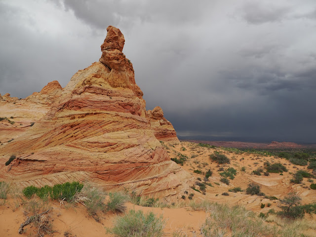
Walking to the Buttes from the parking lotThis is called the Control Tower.
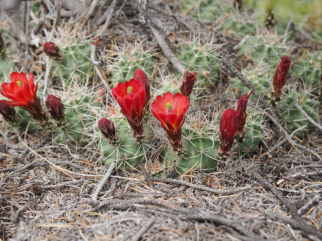
Claret cup.
At the end of this day we met the guide from Dreamland again at the Air Up point and she asked me if I had lockers on my Subaru.
The next day we went to White Pocket. The road is the same as Coyote Buttes but forks and goes a little further.
First view of White Pocket
At the Condor viewing area on House Rock Valley road. There is a cage where they manage the condors.

.jpg)

.jpg)
.jpg)
.jpg)
.jpg)
.jpg)
.jpg)

.jpg)
.jpg)
.jpg)
.jpg)
.jpg)
.jpg)
.jpg)
.jpg)
.jpg)
.jpg)
.jpg)
.jpg)
.jpg)
.jpg)
.jpg)
.jpg)
.jpg)
.jpg)

.jpg)
.jpg)

.jpg)
.jpg)
.jpg)

.jpg)

.jpg)
.jpg)
.jpg)

.jpg)
.jpg)
.jpg)

.jpg)
.jpg)
.jpg)

.jpg)

.jpg)

.jpg)
.jpg)
.jpg)
.jpg)
.jpg)
.jpg)
.jpg)
.jpg)
.jpg)
.jpg)
.jpg)
.jpg)
.jpg)
.jpg)
.jpg)
.jpg)


.jpg)
.jpg)
.jpg)
.jpg)
.jpg)

.jpg)
.jpg)
.jpg)
.jpg)
.jpg)

.jpg)