This hike is 7.5 miles long and is rated moderately strenuous with a fair amount of scrambling. One place a hand strap was used to assist those with shorter legs who couldn't make it. I includes a drive of 3 miles up the Callville wash to shorten the hike from what it would be if we had started at the paved road, where it would be more like 9 miles.
Starting out from the car at the mouth of the canyon that starts other club hikes such as "Behind North Bowl" we headed up the canyon and followed it straight to the cleft in the middle of the red rock cliff face. earlier we passed the side canyon on the left that leads along the left edge of the red rock cliffs to the arches.
Upon reaching the cleft we came to the first boulder scramble.
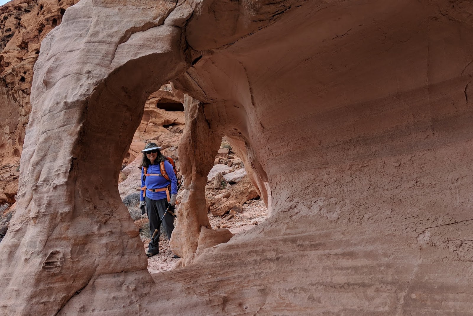
Continuing up the cleft about .25 miles there is a side canyon on the left that immediately comes to this rabbit hole with a very high first step. A strap was used to assist some of the hikers.
A formation known as "kissing aliens" a short way up the wash at the top of the rabbit hole. A few yards further you have to turn left and go up a hill toward a split in two large rocks where there is a chock stone that requires more scrambling and use of hands. There is a bypass on the left we discovered on this trip.
Anyway, if you climb directly over the rock and look straight ahead you can see Snow White in her small cave.
From Snow White we turned right and worked our way up toward the ridge line crossing a vein of white sandstone and dropping into a wash on the other side of the white sandstone and following it further right while looking for a way up to the top of the ridge we had been able to see all along. Once you find your way to the top of the ridge you find your self in a flat clearing that looks like a good place to land a helicopter for a rescue. And you see that you are not actually on top yet. Traverse the flat area to the left to find the ramp pictured here that leads to the Ravens Balcony.
View from the Ravens Balcony.
Going back down the ramp (and slot) there is this alcove on the right. When you get to the flat helicopter pad strike out to the left heading for the left end of a small ridge of white sandstone where you can then descend to a wash and follow it to the west to join the canyon that goes back to the cars if you were on the Behind North Bowl hike.

There is a pour over in the wash leading west. You go around it on the left. It is about 25 feet high. You can't miss it. This little alcove is at the bottom of the pour over on the left. After getting all the way down this westerly wash to the junction of the north south canyon, also called Exit Canyon, which would go by another elephant rock if you turned left, you instead turn right, up wash toward some water features in the narrow part of the canyon. You do not continue through the narrow part of the canyon. Instead, just when you can see it getting narrow head to the west over a ridge while following a side wash. At the top of the ridge you will be in open country. Straight ahead you could drop into a wash back to the cars, or as we did, contour around the shoulder of the hillside to the left to the area where the arches used to be.

What I call "Cartoon Elephant" arch is still there. It was discovered about 2 years ago by Chuck Hawkins. About 200 ft to the south in an obvious basin used to be what I called "Very Delicate Arch" . Apparently the name was appropriate because it is gone now.
How it used to look.
How it looks today.


No comments:
Post a Comment